
091-5758564, 081-6679233 ,02 7035192
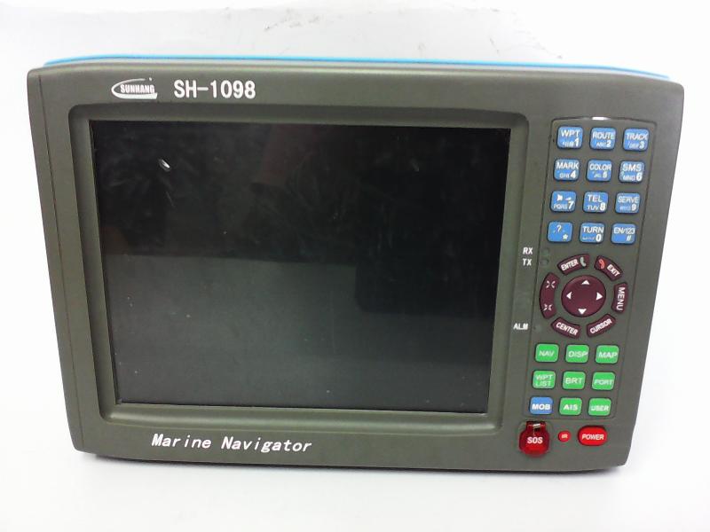
ดาวเทียม SUNHANG-1098
10.4” Multi – purpose Navigator
Thanks for purchasing our SH-1098 10.4inch Marine GPS Navigator It is used high-performance display with bright color and stable pitures. Our imported satellite receiver suits to marine. The high-performance 30 bits ARM choip used for the product processor has fast speed and consumes less. All the data achieves real time storge and it uses solidified storage, which is able to realize lifelong preservation and get rid of the worry about the loss of data caused by accident power-off. The user manual contains full information for easy operation. It has numeric key for fast operation. It convenient and practical will bring you a new pleasure.
We also provide upgrade service for the software and chart for this unit for free. Plaese contact your local Shunhang dealer for lateat information.
Attention: This machine is mainly used to assist your navigation. The chart and navigation data provided by this machine are for reference during your driving. For your navigation safety during the driving, please use this machine based on the actial cirumstances observed and together with other navigation devices, relevant navigation chart and data provided by navigation notica.
- New Water proofing design
- Up to date system and map
- Fast ARM processors to run more fast
- Large, 10.4” (26.4cm) Color Display with Enhanced View ability
- Optional functions of AIS, Sonar ( Fish Finder) ,3G Phone, or Beidou communication
SUNHANG NAVIGATION
Operation Voltage: 13.8 ![]() 36VDC
36VDC
Accuracy: less than 5m
Case Dimensions: L x D x H 331x108x229mm
Crust: Moisture proof, Salt mixt-resistence
Display: 10.4” (26.4cm) color display with 800H X 600V Super resolution
SD Card upgrade: Support
Date transmission: Support
Mark: 10000 marks
Waypoint: 10000 waypoint
Routes: 500 routes ( up to 100 waypoint each )
Track: 24 tracks ( up to 5000 track points each )
Alarms: XTE, Anchor dray, Arrival, Bridge, Clock
Optional function: AIS, Sonar (Fish Finder), 3G Phone, Beidou Communication
Display Page: Chart plotter Display, Satellite Display, Compass Display,
Highway Display
|




 สินค้าที่เกี่ยวข้อง

weight of this product and size